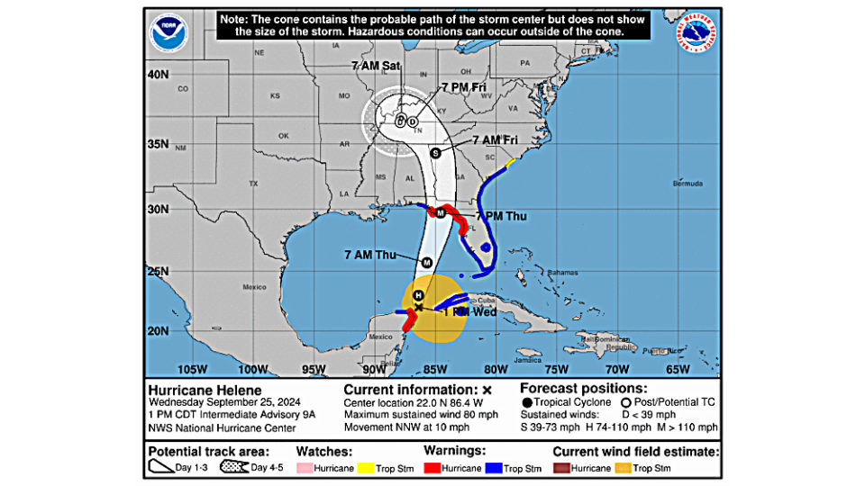
WEST PADUCAH – The National Weather Service in Paducah is closely following the evolution of Hurricane Helene in the Gulf of Mexico as it approaches the Florida Panhandle. After making landfall late in the day Thursday as a major hurricane, the remnants of Helene will move into the Ohio and Tennessee River Valleys Friday and Saturday, where widespread heavy rain is expected.

While rain may begin for portions of the region as early as Thursday night, the heaviest rain looks to fall Friday through Sunday. Rainfall totals of two to three inches are likely regionwide, with locally higher amounts up to five inches not out of the question. While some rumbles of thunder are possible, severe thunderstorms are not anticipated at this time.
Much of the late summer and early fall season has been marked by above normal temperatures and below normal rainfall. Rainfall from the remnants of Helene will provide much-needed relief from the ongoing drought conditions. However, where the heaviest rains fall, minor flooding issues, particularly in low-lying or poorly-drained locations, are possible.
Some actions items to you can take to minimize potential flood problems include making sure your gutters and downpours are clear of leaves, and that storm drains and ditches are not blocked or obstructed by leaves or trash.
For more information from the National Weather Service in Paducah:
Forecast Hotline: 270-744-6331
Website: weather.gov/paducah
For more information on Product:
NOAA One Stop Shop: noaa.gov/Helene
National Hurricane Center: nhc.noaa.gov
